


2023-04-18_11h00m14_Boucle de l'Abbaye du Thoronet

jpb83
User
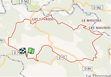

Length
13.4 km

Max alt
207 m

Uphill gradient
297 m
Km-Effort
17.4 km

Min alt
101 m

Downhill gradient
294 m
Boucle
Yes
Creation date :
2023-04-18 09:00:15.06
Updated on :
2023-07-29 06:04:29.141
3h57
Difficulty : Difficult

FREE GPS app for hiking
 SityTrail
IGN / Geographical institutes
SityTrail Plus
The world is yours!
About
Trail Walking of 13.4 km to be discovered at Provence-Alpes-Côte d'Azur, Var, Le Thoronet. This trail is proposed by jpb83.
Positioning
Country:
France
Region :
Provence-Alpes-Côte d'Azur
Department/Province :
Var
Municipality :
Le Thoronet
Location:
Unknown
Start:(Dec)
Start:(UTM)
278537 ; 4815527 (32T) N.
Comments